Building date: 1841 per Roudabush, 1845 per Palmer
Original use: Outhouse
Corner structures: The quoins in one of the back corners are a mixture of gray limestone, brown sandstone and red bricks.
Mortar application and content:
Types and uses of stones:
Types and choice of windows:
Structures with similar masonry details:
Masons who worked on building:
Unique features:
Map views courtesy Google Maps. Address is Google Earth confirmed; 43°01'36.58"N 77°26'18.05"W. Current owner of record, Historic High Point Retail LLC as of the 2019 Tax Roll.
Town of Victor and Ontario County Maps (4a is at the same location as 4 on both maps.)
At the southwest corner of this house, there is a double outhouse, which is being used for storage. The quoins in one of the back corners are a mixture of gray limestone, brown sandstone and red bricks. Roudabush Survey page 91
236 High St. Ext., Victor, District 7 schoolhouse and out building, built in 1845. Richard Palmer blog.
 Vic_4a_1.jpg |  Vic_4a_2.jpg |  Vic_4a_3.jpg | 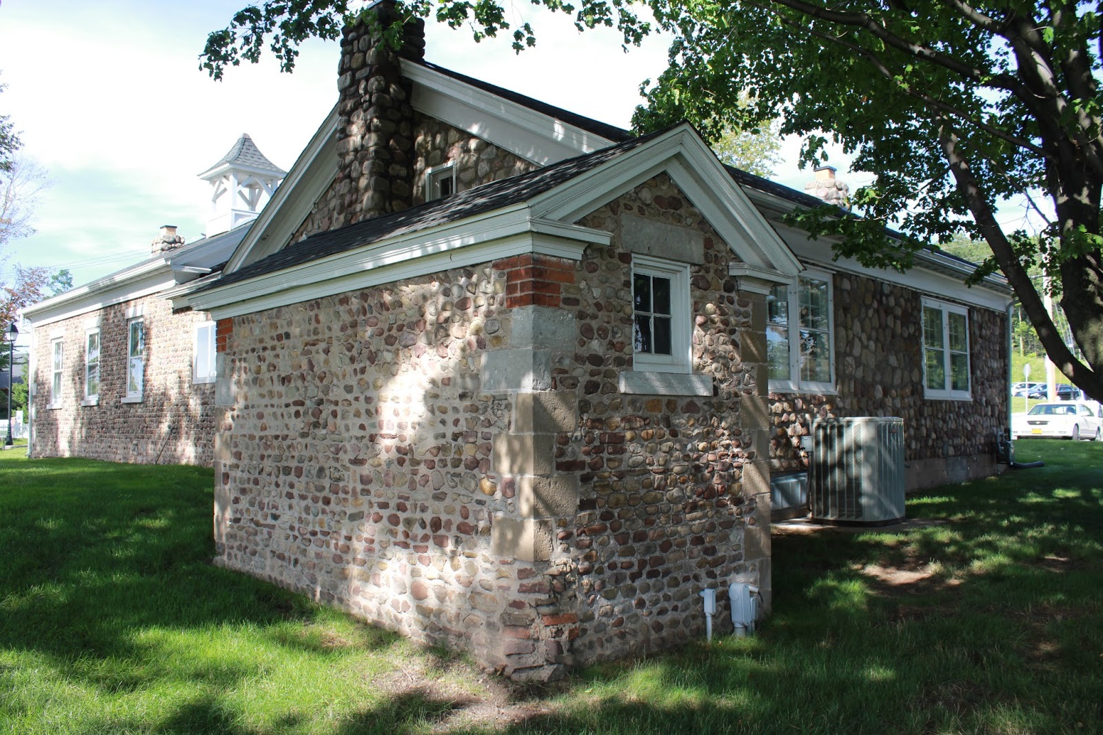 IMG_1480.jpg ¹ out building |
¹ Photography courtesy Richard Palmer.
